

.jpg)
.jpg)
.jpg)


.jpg)

.jpg)
.jpg)
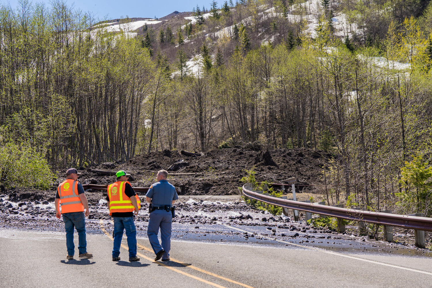
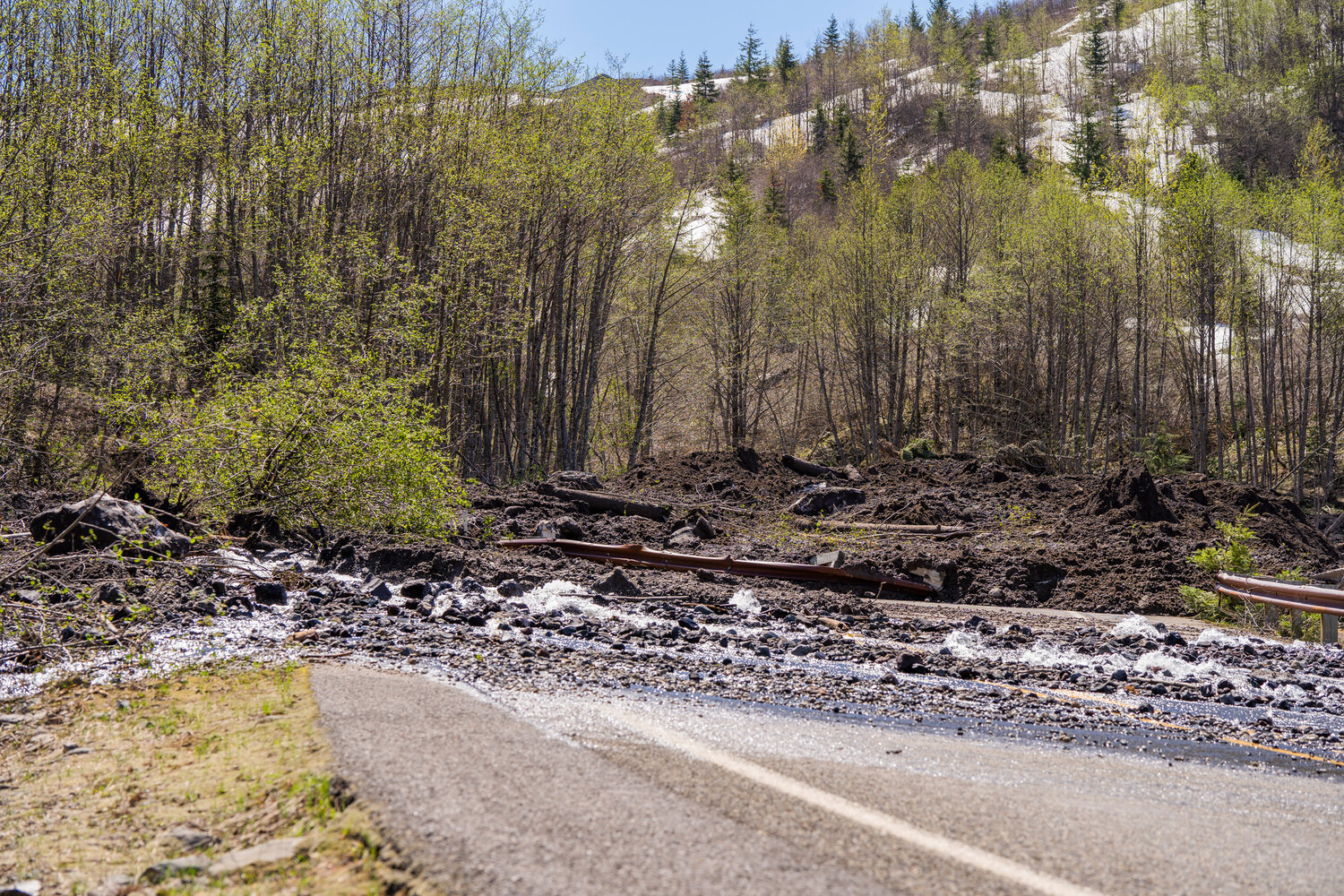
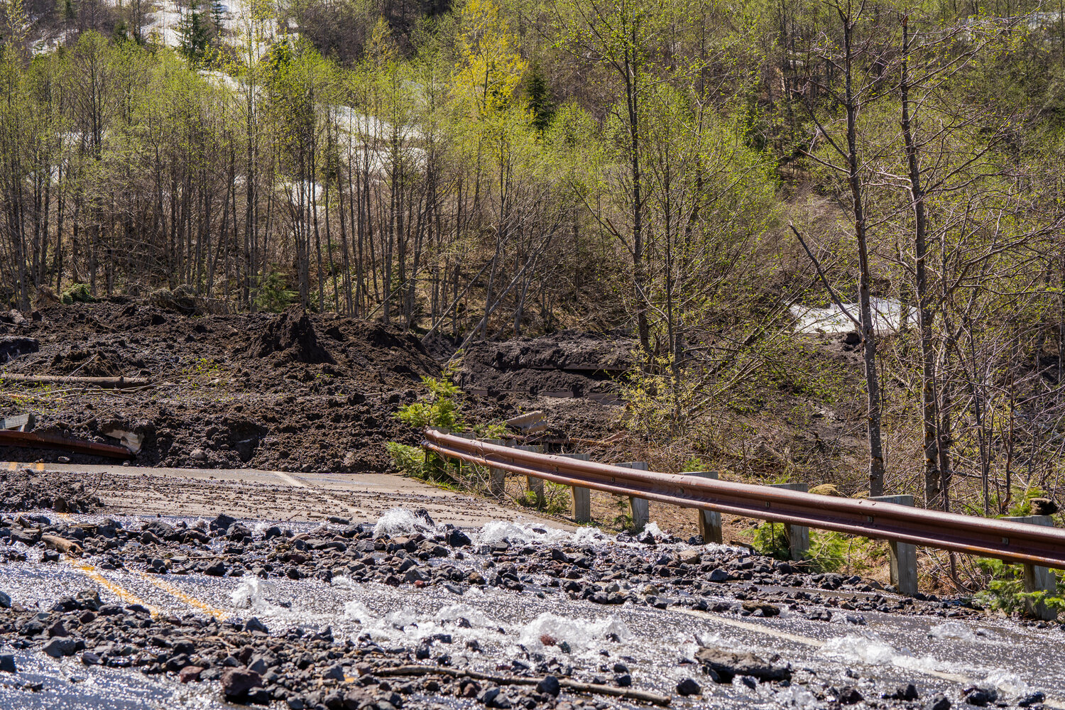
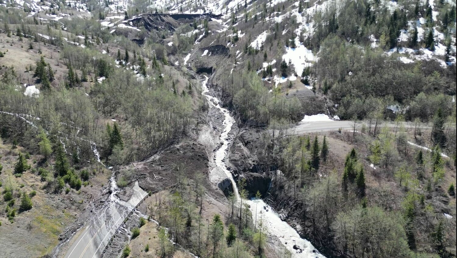
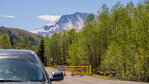
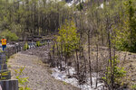
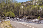
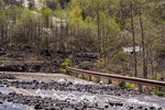
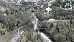
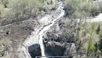
A massive landslide on Sunday, May 14 took out a section of the upper portion of state Route 504, also known as Spirit Lake Highway.
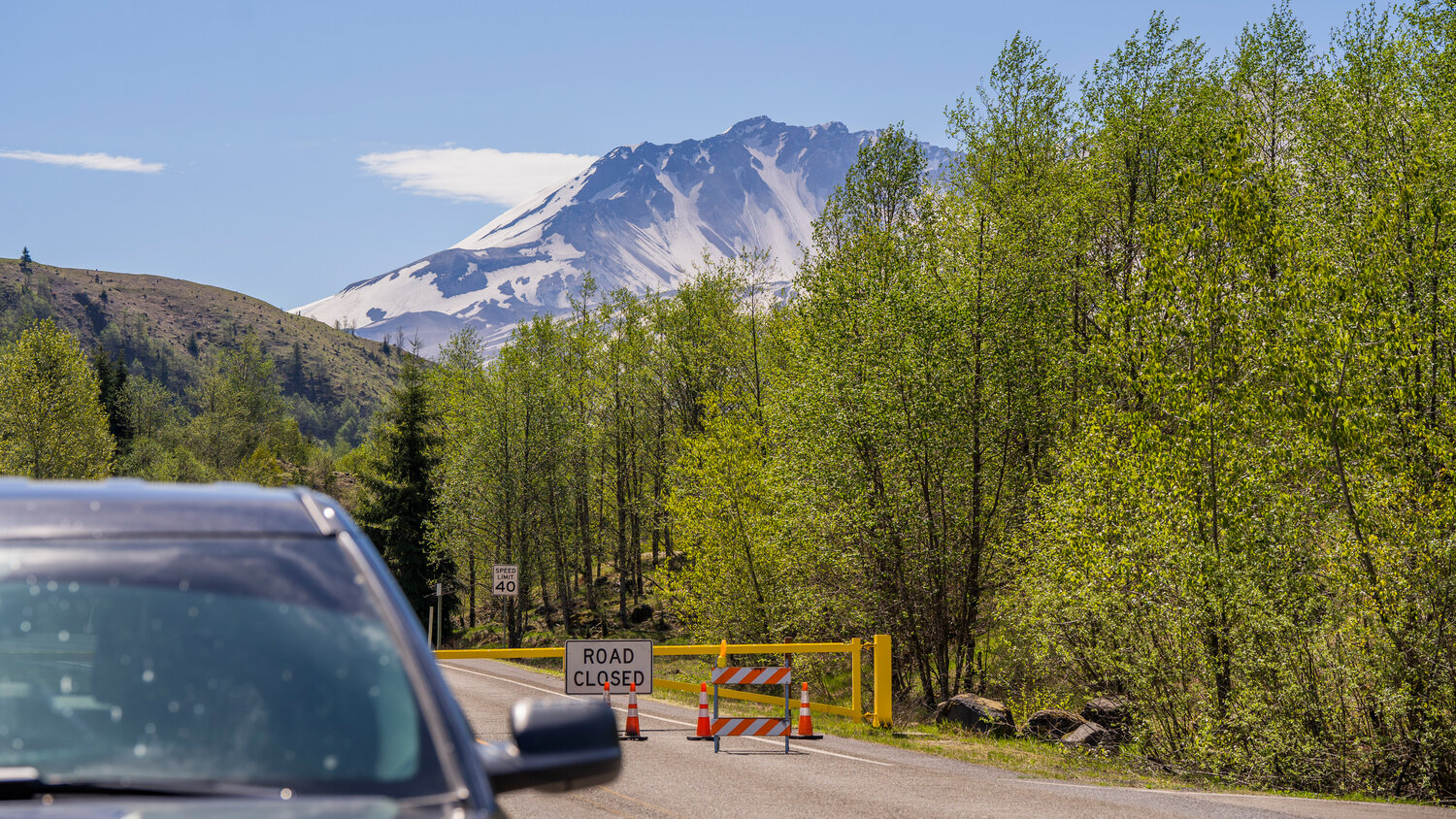
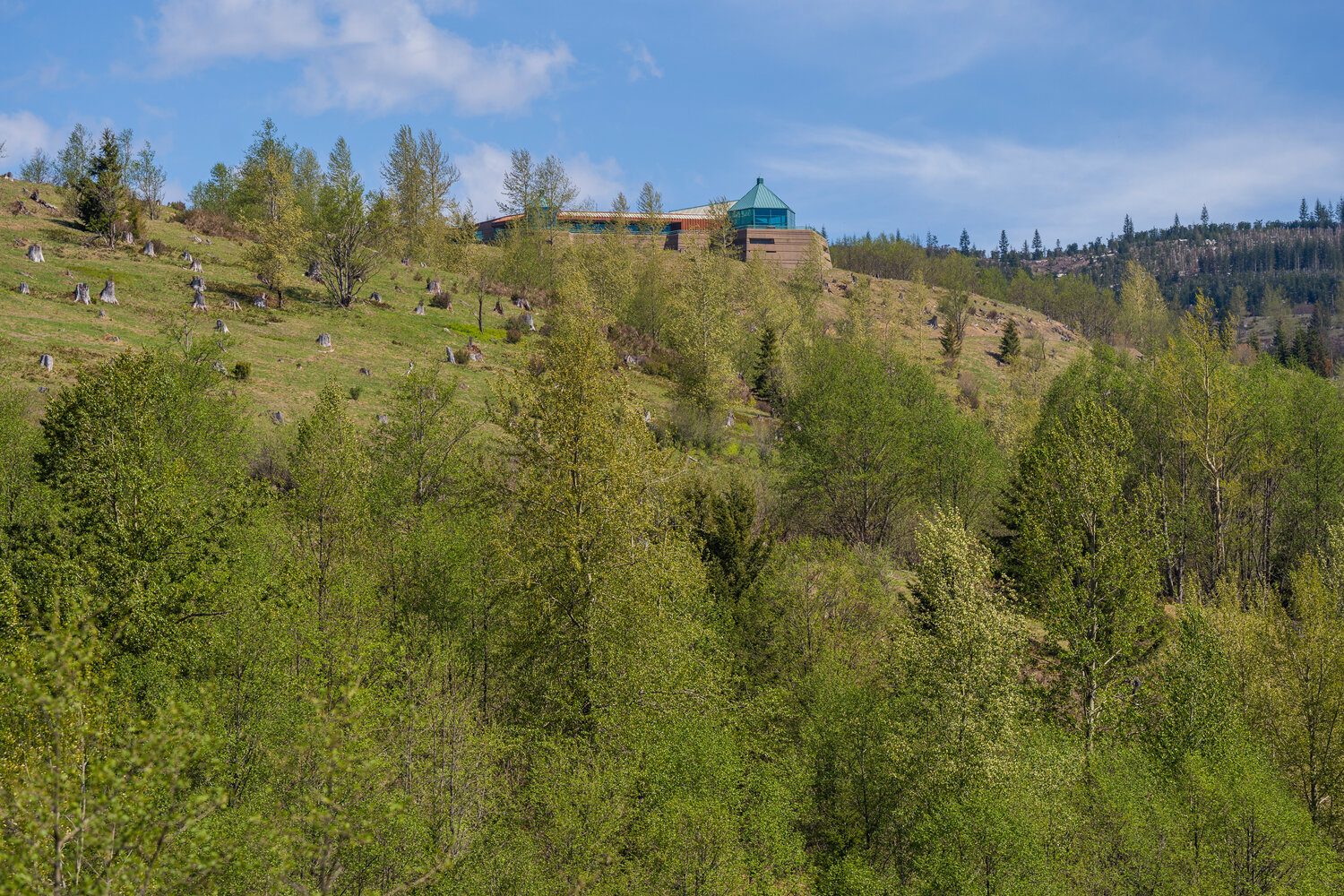
As of last week, only one thing was certain: It’s going to be a long time before travelers can make it up to the Johnston Ridge Observatory or other upper reaches of the road, which takes drivers from Castle Rock to Mount St. Helens.
A news release from the Washington State Department of Transportation (WSDOT) stated the cause of the slide and the timeline for the road’s repair have not been determined.
“Travelers should plan for the highway to be closed for an extended period,” the release read.
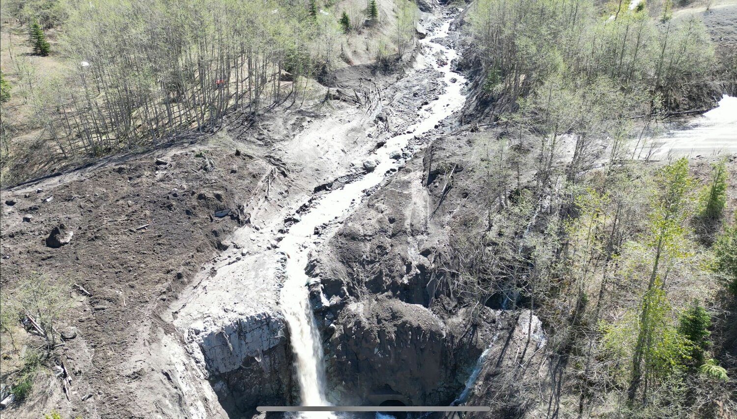
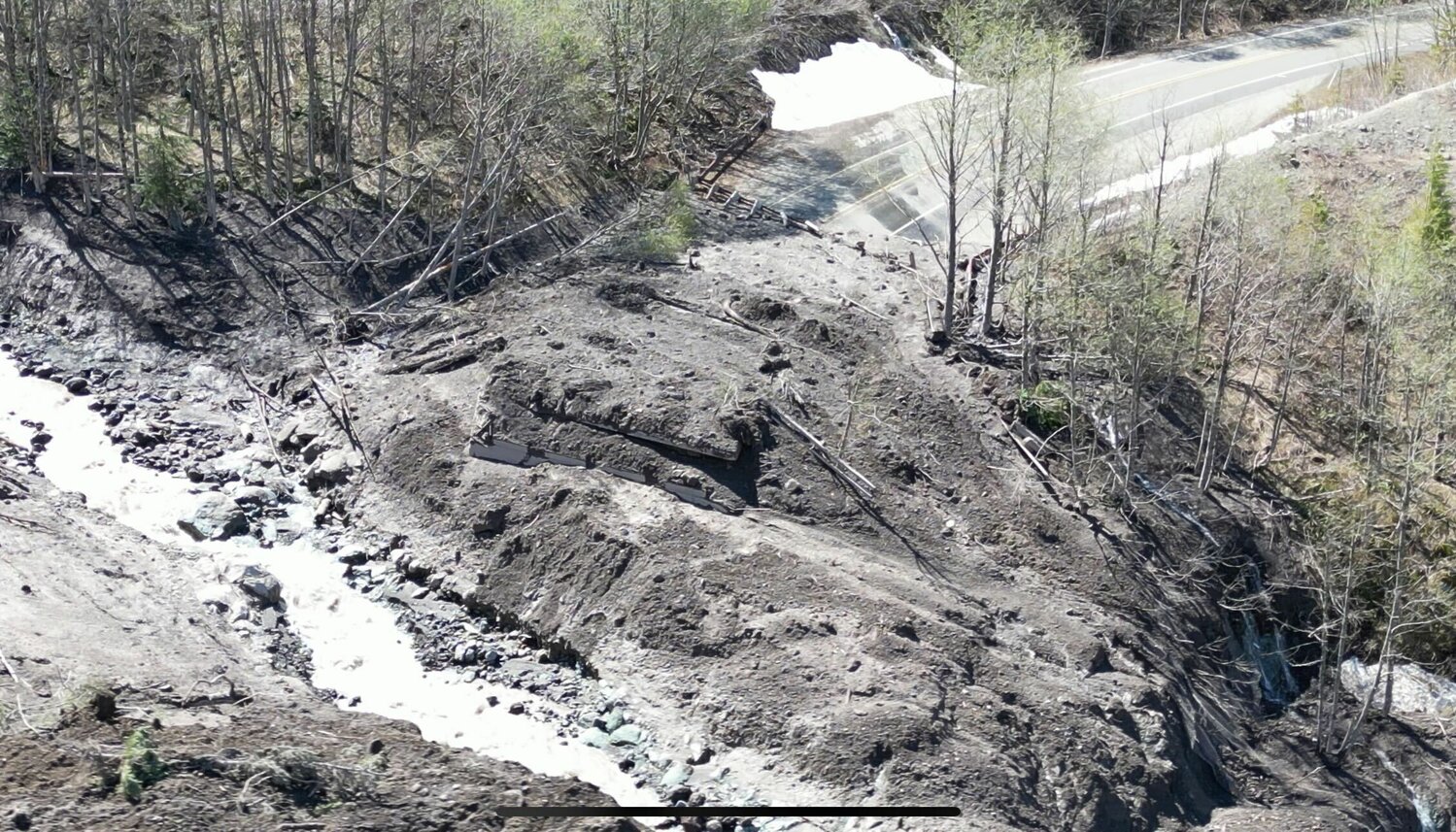
The slide washed out an 85-foot bridge, damaged the roadway, and severed power to Johnston Ridge Observatory, stated a news release from the USDA Forest Service on Friday, May 19.
No one was injured because of the incident and 12 members of the public who were stranded overnight at Johnston Ridge Observatory were safely flown out the following morning. Those people and one dog were rescued by the King County Sheriff’s Office.
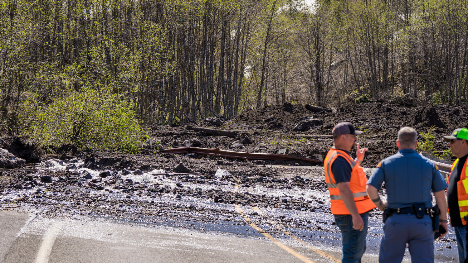
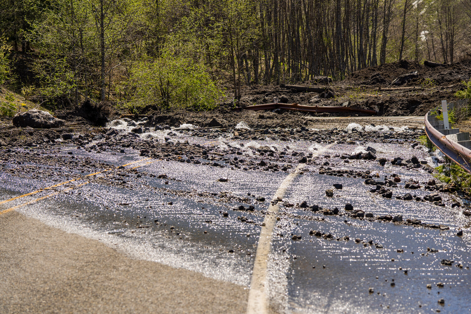
WSDOT last week stated the debris from an adjacent hillside fell about 2,000 feet and “covered the roadway with rock, mud, ice and water, causing catastrophic damage to the Spirit Lake Outlet Bridge.”
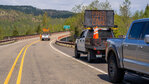
Brad Clark, WSDOT southwest region maintenance manager, said due to the ongoing “geological instability” in the area, it’s too soon to say if crews will be able to safely work on the road, let alone the timeline for its repair.
For the foreseeable future, the highway will be closed at milepost 43 near the Science and Learning Center, which overlooks Coldwater Lake. This means there is currently no access to Coldwater Lake, the Hummocks Trail and the Johnston Ridge Observatory.
“There is no detour available. WSDOT strongly encourages visitors to not venture beyond the closure location due to the severity of the unstable hillside — the closure is in place for everyone’s safety,” the release stated.
While the cause is yet to be officially determined, WSDOT’s initial assessment was that unseasonably hot temperatures likely drastically melted the snowpack and the extra liquid oversaturated soils and overfilled the channels of the slopes, causing debris to join high water, which built up and then broke free, rolling downstream washing out the 85-foot bridge span and roadway.
WSDOT and federal agencies are working together to assess the slide area and develop next steps, stated the release from the Forest Service. Due to continued landslide instability, data collection is being conducted from the air.
WSDOT was scheduled to conduct a fixed wing aircraft LIDAR (laser imaging, detection and ranging) flight over the area on Friday, May 19 to gather preliminary data if weather conditions allowed it.
“This is an important step in collecting data to help inform when on-site access, cleanup and work can begin,” stated the release. “It is too soon to tell when crews may be able to access the slide from the ground or when the highway may reopen.”
A National Incident Management Organization team arrived on Friday, May 19 to support coordination across agencies.
The USDA Forest Service is in the process of exploring alternative options for visitors who would like to visit the north side of the Mount St. Helens National Volcanic Monument this summer and to develop a plan to manage the influx of visitors in a safe manner.
Several other visitor centers located along state Route 504 remain open to the public, including scenic viewpoints where visitors can see Mount St. Helens and learn about the history, eruption and recovery of the volcano, stated the release from the Forest Service. As the snow melts and forest service roads open for the season, additional sites on the monument and surrounding communities will begin to open for visitors to explore.
Trips to Mount St. Helens this summer will still be possible at Windy Ridge via Randle on the northern side of the mountain and to the Ape Cave on the southern side via Cougar.
To check the latest traffic issues, visit WSDOT’s recently updated real-time travel map at wsdot.com/Travel/Real-time/Map or follow WSDOT’s Southwest Washington-area Twitter account. To stay up-to-date on which Forest Service facilities are open, check out the Gifford Pinchot National Forest website at fs.usda.gov/giffordpinchot.